March 5, 2026 by Steve Martin, Purdue University
Collected at: https://techxplore.com/news/2026-03-radar-technology-radius-underground-pipes.html
Purdue University engineers have developed a patent-pending method to decrease hazardous strikes to underground utility pipes during construction projects. This could lower related financial losses, service disruptions, injuries and fatalities.
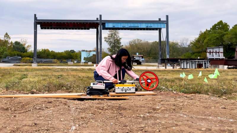
Hubo Cai and Yuxi Zhang are improving upon traditional ground-penetrating radar (GPR) data to better estimate the location, orientation and radius of underground utility pipes. Cai is a professor and the associate head of Purdue’s Lyles School of Civil and Construction Engineering and Zhang is a doctoral candidate in civil engineering.
Cai said GPR provides a nondestructive technique to locate pipes by analyzing the electromagnetic wave reflections and resulting hyperbolic reflections. But it often overlooks inherent uncertainties and issues related to data quality.
“Our uncertainty-aware model compensates for this gap by robustly quantifying uncertainty in order to create a buffer zone,” he said. “With this improvement, construction contractors, utility-locating service providers and excavator manufacturers can better interpret GPR data, supporting safer and more effective underground utility mapping.”
Cai and Zhang’s research has been published in Advanced Engineering Informatics.
Validating the Purdue solution
Cai and Zhang’s research uses a Bayesian framework for quantifying uncertainty in estimating underground pipe depth, horizontal position, orientation and radius.
“A forward model was developed for predicting electromagnetic wave travel times from 3D pipe geometries,” Cai said. “We also created a statistical inference framework for quantifying uncertainties in estimated pipe parameters. The framework was shown to output credible intervals and provide measures of estimation reliability.”
Cai and Zhang also developed diagnostic metrics for GPR data quality, including quantitative measures of completeness and consistency.
“The forward model achieves an RMSE (root mean square error) of 0.454 ns when validated against high-fidelity simulations, demonstrating strong predictive accuracy with reduced computational cost,” Cai said. “Among all configurations, the VI+MCMC (Variational Inference and Markov Chain Monte Carlo) approach using a normal likelihood model yielded the highest average coverage rates—97.5% on simulated data and 77.5% on field data—validating the effectiveness of the framework.”
The cost of damaged underground pipes
Zhang said the Common Ground Alliance estimated in 2019 that the annual total social costs of underground infrastructure damage in the United States reached approximately $30 billion.
“According to the 2022 Damage Information Reporting Tool, 87.84% of these incidents resulted from inaccurate location information,” she said.
The lack of complete and reliable records also creates a bottleneck in transportation project delivery attributed to utility conflicts, construction activities or phasing, existing utilities, or failing to comply with accommodation policies and safety regulations.
“Failure to promptly identify and resolve utility conflicts leads to cost overruns, schedule delays, public safety hazards and service outages,” Zhang said. “Therefore, effective tools for locating underground pipelines are the first step toward building a digital twin of the massive underground infrastructure.”
More information
Yuxi Zhang et al, Uncertainty-aware localization and orientation estimation of underground pipelines from GPR data, Advanced Engineering Informatics (2026). DOI: 10.1016/j.aei.2025.104093
Leave a Reply